Old Boundary Marker near Ellercow
Introduction
The photograph on this page of Old Boundary Marker near Ellercow by Colin Smith as part of the Geograph project.
The Geograph project started in 2005 with the aim of publishing, organising and preserving representative images for every square kilometre of Great Britain, Ireland and the Isle of Man.

There are currently over 7.5m images from over 14,400 individuals and you can help contribute to the project by visiting https://www.geograph.org.uk
Old Boundary Marker near Ellercow
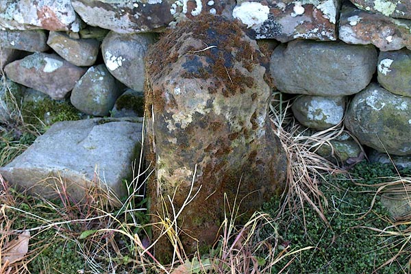
Image: © Colin Smith Taken: 8 Aug 2015
Parish Boundary Marker against the bridge parapet over Little Briggle Beck, on the west side of the road southeast of Ellercow. Inscribed TOWNSHIP / OF / HUNSONBY and TOWNSHIP / OF / SKIRWITH on adjacent faces. On the boundary of Hunsonby and Skirwith parishes. Skirwith was absorbed into Culgaith parish in 1934. Grade II Listed details https://historicengland.org.uk/listing/the-list/list-entry/1326978. See also https://www.lakesguides.co.uk/photos/CCM19.jpg. Milestone Society National ID: CU_HUNCUL01pb
Images are licensed for reuse under creativecommons.org/licenses/by-sa/2.0
Image Location
Latitude
54.703246
Longitude
-2.627904