Old Milestone by the A595, east of Aldersceugh
Introduction
The photograph on this page of Old Milestone by the A595, east of Aldersceugh by Barbara Todd as part of the Geograph project.
The Geograph project started in 2005 with the aim of publishing, organising and preserving representative images for every square kilometre of Great Britain, Ireland and the Isle of Man.

There are currently over 7.5m images from over 14,400 individuals and you can help contribute to the project by visiting https://www.geograph.org.uk
Old Milestone by the A595, east of Aldersceugh
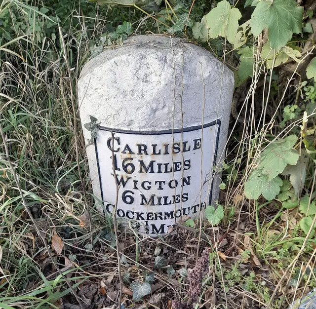
Image: © Barbara Todd Taken: 12 Oct 2023
Metal plate attached to stone post by the A595, in parish of BOLTONS (ALLERDALE District), Aldersceugh, 100m West of Coach House Restaurant, in shrub, on North side of road. Carlisle red stone and curved plate, erected by the Cockermouth & Carlisle turnpike trust in the 19th century. Inscription reads:- CARLISLE 16 MILES WIGTON 6 MILES COCKERMOUTH 9½ MILES Carved benchmark. Grade II Listed. List Entry Number: 1312188 https://historicengland.org.uk/listing/the-list/list-entry/1312188 Milestone Society National ID: CU_CLCM16.
Images are licensed for reuse under creativecommons.org/licenses/by-sa/2.0
Image Location
Latitude
54.759381
Longitude
-3.243492