B3191 road closed indefinitely, Watchet
Introduction
The photograph on this page of B3191 road closed indefinitely, Watchet by Martin Tester as part of the Geograph project.
The Geograph project started in 2005 with the aim of publishing, organising and preserving representative images for every square kilometre of Great Britain, Ireland and the Isle of Man.

There are currently over 7.5m images from over 14,400 individuals and you can help contribute to the project by visiting https://www.geograph.org.uk
B3191 road closed indefinitely, Watchet
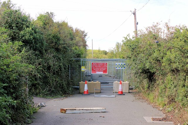
Image: © Martin Tester Taken: 23 Sep 2023
Coastal erosion forced the closure in January of the B3191 linking Watchet with Blue Anchor over Cleeve Hill. A subsequent geotechnical survey has resulted in the closure being reported as indefinite. See: https://www.somerset.gov.uk/council-and-partners-mobilise-in-watchet-following-loss-of-key-route-into-town/.
Images are licensed for reuse under creativecommons.org/licenses/by-sa/2.0
Image Location


Leaflet Map data © OpenStreetMap
Latitude
51.182158
Longitude
-3.339098