Cobham Mill and the River Mole
Introduction
The photograph on this page of Cobham Mill and the River Mole by Nigel Cox as part of the Geograph project.
The Geograph project started in 2005 with the aim of publishing, organising and preserving representative images for every square kilometre of Great Britain, Ireland and the Isle of Man.

There are currently over 7.5m images from over 14,400 individuals and you can help contribute to the project by visiting https://www.geograph.org.uk
Cobham Mill and the River Mole
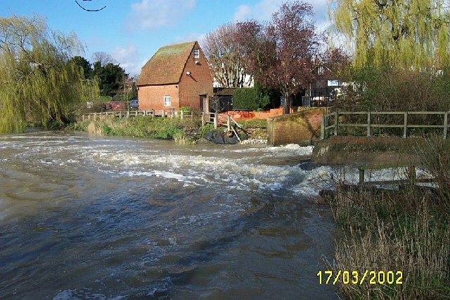
Image: © Nigel Cox Taken: 17 Mar 2002
Originally there were two mills here with waterwheels between them. The older mill was demolished to enable Mill Road to be straightened in the early 1950s. The remaining mill building dates from 1822 and was in use grinding corn until the 1920s. The Cobham Mill Preservation Trust was set up in 1985 to restore the mill to full working order. It was opened to the public in 1993 and is a Grade II listed building. This view was taken on a day when the River Mole was in full spate.
Images are licensed for reuse under creativecommons.org/licenses/by-sa/2.0
Image Location
Latitude
51.327358
Longitude
-0.406834