Northumberland Street Peace Gate and Murals
Introduction
The photograph on this page of Northumberland Street Peace Gate and Murals by David Dixon as part of the Geograph project.
The Geograph project started in 2005 with the aim of publishing, organising and preserving representative images for every square kilometre of Great Britain, Ireland and the Isle of Man.

There are currently over 7.5m images from over 14,400 individuals and you can help contribute to the project by visiting https://www.geograph.org.uk
Northumberland Street Peace Gate and Murals
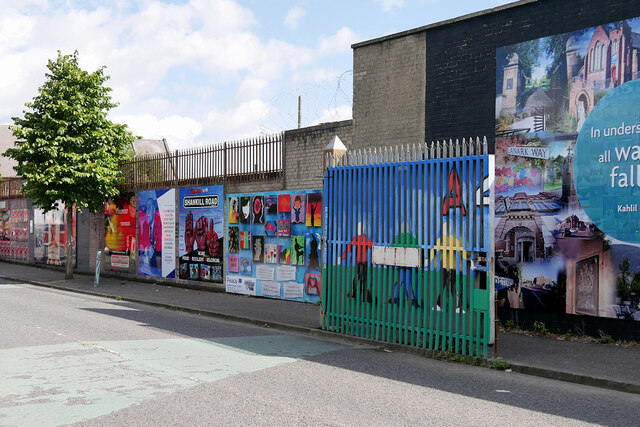
Image: © David Dixon Taken: 16 Aug 2023
Northumberland Street is a street in West Belfast that connects Divis Street and Shankill Road. It is one of several streets that link Loyalist and Republican communities in the area. The International Wall on Divis Street extends up Northumberland Street along its western perimeter and continues around into Beverley Street on the northern perimeter. There are two sets of security gates across Northumberland Street, Northumberland Street is divided by two sets of security gates, forming a part of the lengthy "peace" line. Despite the Good Friday Agreement of 1998, the Peace Wall, which stands at around six metres tall, still marks the boundary between the Republican and Loyalist areas of Belfast. The gate located at Northumberland Street shuts every evening at 8 pm. The murals on Northumberland Street are a mix of international and local concerns.
Images are licensed for reuse under creativecommons.org/licenses/by-sa/2.0
Image Location
Latitude
54.600579
Longitude
-5.947241