RNLI offices, Custom House Lane, Plymouth
Introduction
The photograph on this page of RNLI offices, Custom House Lane, Plymouth by Stephen Craven as part of the Geograph project.
The Geograph project started in 2005 with the aim of publishing, organising and preserving representative images for every square kilometre of Great Britain, Ireland and the Isle of Man.

There are currently over 7.5m images from over 14,400 individuals and you can help contribute to the project by visiting https://www.geograph.org.uk
RNLI offices, Custom House Lane, Plymouth
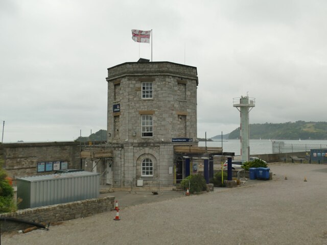
Image: © Stephen Craven Taken: 28 Jun 2023
The grade II listed 19th century structure was originally the dock customs tower and later a police station. It's now called a lifeboat station, but not in the sense that boats are launched from here, though there does appear to be a radar mast. List entry 1113301.
Images are licensed for reuse under creativecommons.org/licenses/by-sa/2.0
Image Location
Latitude
50.363034
Longitude
-4.150387