St Constantine's Church
Introduction
The photograph on this page of St Constantine's Church by Rob Farrow as part of the Geograph project.
The Geograph project started in 2005 with the aim of publishing, organising and preserving representative images for every square kilometre of Great Britain, Ireland and the Isle of Man.

There are currently over 7.5m images from over 14,400 individuals and you can help contribute to the project by visiting https://www.geograph.org.uk
St Constantine's Church
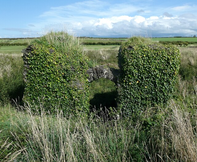
Image: © Rob Farrow Taken: 1 Sep 2023
The western end of the ruinous St Constantine's Church. These ivy-clad walls with Image] are the most significant remains of the mediaeval church still standing. The church is at the top of a little hillock in the midst of Image] There are some fragments of tracery which have been removed to Image] - they can be seen here Image] For a view of this western end looking from the other side, see Image] The ruins are EH Grade II listed: https://historicengland.org.uk/listing/the-list/list-entry/1289416?section=official-list-entry With Image] it is a Scheduled Ancient Monument: https://historicengland.org.uk/listing/the-list/list-entry/1018569?section=official-list-entry
Images are licensed for reuse under creativecommons.org/licenses/by-sa/2.0
Image Location
Latitude
50.534639
Longitude
-5.013988