The Street
Introduction
The photograph on this page of The Street by Simon Carey as part of the Geograph project.
The Geograph project started in 2005 with the aim of publishing, organising and preserving representative images for every square kilometre of Great Britain, Ireland and the Isle of Man.

There are currently over 7.5m images from over 14,400 individuals and you can help contribute to the project by visiting https://www.geograph.org.uk
The Street
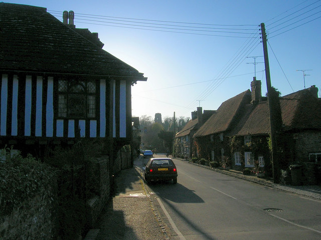
Image: © Simon Carey Taken: 8 Apr 2008
Looking down the main village street originally built as a causeway to cross the former Adur estuary. Two 15th century buildings are in view. To the left is St Mary's House built for the warden of the bridge and originally known as Chapel House, and to the right is the Old Priory, formerly Priory House, originally owned by nearby Sele Priory. Overlooking both in the distance is the remains of the Norman keep of Bramber Castle.
Images are licensed for reuse under creativecommons.org/licenses/by-sa/2.0
Image Location


Leaflet Map data © OpenStreetMap
Latitude
50.882868
Longitude
-0.312578