Old Boundary Marker in Bourne Hall Museum, Ewell
Introduction
The photograph on this page of Old Boundary Marker in Bourne Hall Museum, Ewell by W Cosgrave as part of the Geograph project.
The Geograph project started in 2005 with the aim of publishing, organising and preserving representative images for every square kilometre of Great Britain, Ireland and the Isle of Man.

There are currently over 7.5m images from over 14,400 individuals and you can help contribute to the project by visiting https://www.geograph.org.uk
Old Boundary Marker in Bourne Hall Museum, Ewell
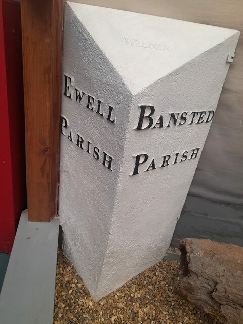
Image: © W Cosgrave Taken: 1 Aug 2023
Parish Boundary Marker on display in Bourne Hall Museum, Spring Street, Ewell KT17 1UF. Milestone Society National ID: SY_EWEBAN01pb
Images are licensed for reuse under creativecommons.org/licenses/by-sa/2.0
Image Location
Latitude
51.350104
Longitude
-0.252001