Old Boundary Marker in Belmont Haywood Country Park
Introduction
The photograph on this page of Old Boundary Marker in Belmont Haywood Country Park by Roadside Relics as part of the Geograph project.
The Geograph project started in 2005 with the aim of publishing, organising and preserving representative images for every square kilometre of Great Britain, Ireland and the Isle of Man.

There are currently over 7.5m images from over 14,400 individuals and you can help contribute to the project by visiting https://www.geograph.org.uk
Old Boundary Marker in Belmont Haywood Country Park
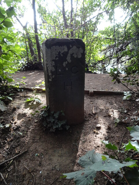
Image: © Roadside Relics Taken: 7 Aug 2023
Municipal Boundary Marker on the east dam wall of Belmont Pool in Belmont Haywood Country Park. On the boundary of Clehonger and Hereford St Martin parishes until 1932, and since then Clehonger and Hereford parishes. The inscription L / C H represents Liberties of the City of Hereford. Milestone Society National ID: HF_HERCLE01pb
Images are licensed for reuse under creativecommons.org/licenses/by-sa/2.0
Image Location
Latitude
52.038424
Longitude
-2.745858