Kingsbridge buildings [68]
Introduction
The photograph on this page of Kingsbridge buildings [68] by Michael Dibb as part of the Geograph project.
The Geograph project started in 2005 with the aim of publishing, organising and preserving representative images for every square kilometre of Great Britain, Ireland and the Isle of Man.

There are currently over 7.5m images from over 14,400 individuals and you can help contribute to the project by visiting https://www.geograph.org.uk
Kingsbridge buildings [68]
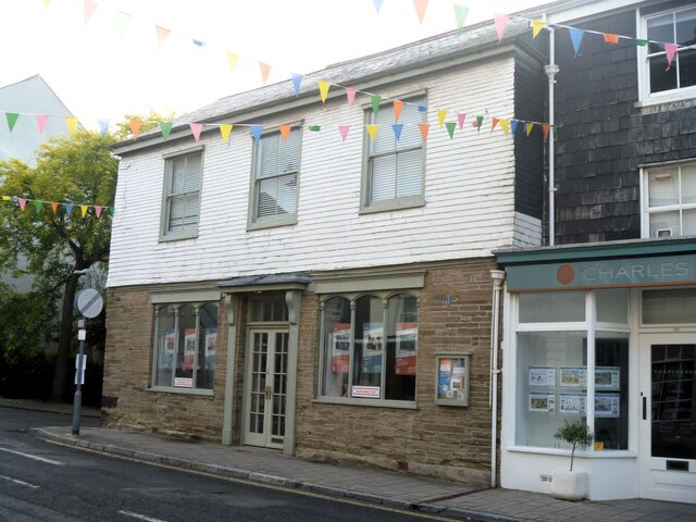
Image: © Michael Dibb Taken: 26 Jun 2023
Number 115 Fore Street was probably built in the 18th century and is used as offices. Constructed of stone with a hung slate upper floor under a slate roof. Listed, grade II, with details at: https://historicengland.org.uk/listing/the-list/list-entry/1263772 Kingsbridge is a market town in the South Hams district of Devon. It is located at the head of an estuary some 17 miles southwest of Torquay and about 17 miles southeast of Plymouth. The town formed around a bridge built in or before the 10th century between two royal estates, giving it the name of Kyngysbrygge ("King's bridge"). Situated in the South Devon Area of Outstanding Natural Beauty and close to the South Devon coast, the town is a popular tourist destination.
Images are licensed for reuse under creativecommons.org/licenses/by-sa/2.0
Image Location


Leaflet Map data © OpenStreetMap
Latitude
50.286936
Longitude
-3.777679