Old milestone
Introduction
The photograph on this page of Old milestone by Chris Minto as part of the Geograph project.
The Geograph project started in 2005 with the aim of publishing, organising and preserving representative images for every square kilometre of Great Britain, Ireland and the Isle of Man.

There are currently over 7.5m images from over 14,400 individuals and you can help contribute to the project by visiting https://www.geograph.org.uk
Old milestone
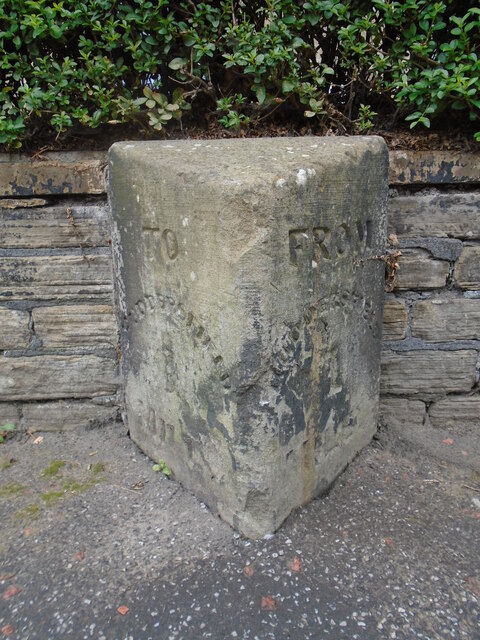
Image: © Chris Minto Taken: 13 Aug 2023
Over 40 of these stones were erected on roads radiating from the centre of Huddersfield to its pre 20C boundaries. They were to regulate the carriage fares. The first one on each route would be at 1 mile, then each following ½ mile. This 1 Mile stone is on the A641, Bradford Road, Fartown outside No.246. Depending on which side of the road they were set determined which face had TO Huddersfield and which had FROM.
Images are licensed for reuse under creativecommons.org/licenses/by-sa/2.0
Image Location
Latitude
53.65937
Longitude
-1.781155