
St Mary de Haura Church, Shoreham-by-Sea - ruined nave
Introduction
The photograph on this page of St Mary de Haura Church, Shoreham-by-Sea - ruined nave by Stephen McKay as part of the Geograph project.
The Geograph project started in 2005 with the aim of publishing, organising and preserving representative images for every square kilometre of Great Britain, Ireland and the Isle of Man.

There are currently over 7.5m images from over 14,400 individuals and you can help contribute to the project by visiting https://www.geograph.org.uk
St Mary de Haura Church, Shoreham-by-Sea - ruined nave
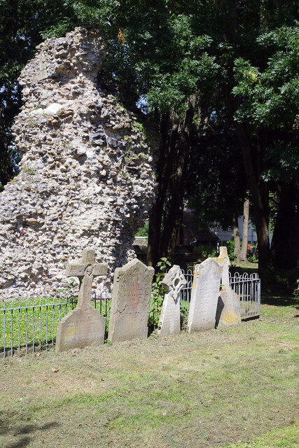
Image: © Stephen McKay Taken: 16 Aug 2023
The western end of the nave collapsed around 1700 although exactly why is not known. Certainly, by that time, Shoreham had become less important than it was in medieval times and it is known that the nave had fallen into a state of disrepair, the town probably no longer able to maintain such a large church. It is also possible that the church was damaged in the English Civil War and a ferocious storm in 1703 might have finally finished the building off. What remains is visible here in the churchyard, surrounded by gravestones.
Images are licensed for reuse under creativecommons.org/licenses/by-sa/2.0
Image Location

Latitude
50.832854
Longitude
-0.274903