Old Guide stone, on Rudding Lane
Introduction
The photograph on this page of Old Guide stone, on Rudding Lane by John Turner as part of the Geograph project.
The Geograph project started in 2005 with the aim of publishing, organising and preserving representative images for every square kilometre of Great Britain, Ireland and the Isle of Man.

There are currently over 7.5m images from over 14,400 individuals and you can help contribute to the project by visiting https://www.geograph.org.uk
Old Guide stone, on Rudding Lane
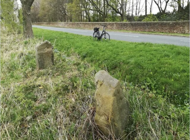
Image: © John Turner Taken: 18 Apr 2020
Once located on the North side of Pannal Road; now on Rudding Lane, 10 metres beyond the Bends sign on the East side of road (obscured by bushes more recently). Carved stone post, erected originally by an unknown authority, 18th century. An earlier photograph can be found here https://www.geograph.org.uk/photo/6739333. Inscription reads: SW: ( hand ) / Roade to / Leed(s) / 9 Miles // SE: {Right pointing hand} / Roade to / Spofforth / 2 Miles // NE: {Right pointing hand} / Roade to / Knaresbr / ough {curved line} / 2 Miles // NW: {Right pointing hand} / Roade to / Harrogate / 1 Mile Milestone Society National ID: YN_XFOL
Images are licensed for reuse under creativecommons.org/licenses/by-sa/2.0
Image Location
Latitude
53.972065
Longitude
-1.499866