Fore Street, Chard
Introduction
The photograph on this page of Fore Street, Chard by Derek Harper as part of the Geograph project.
The Geograph project started in 2005 with the aim of publishing, organising and preserving representative images for every square kilometre of Great Britain, Ireland and the Isle of Man.

There are currently over 7.5m images from over 14,400 individuals and you can help contribute to the project by visiting https://www.geograph.org.uk
Fore Street, Chard
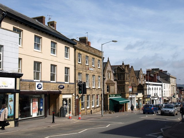
Image: © Derek Harper Taken: 4 Apr 2008
Interesting buildings line the northern side of Fore Street opposite Image The Nat West bank behind the traffic light dates from 1820, an attractive Ham Hill stone building with rustication to the ground floor. Next door but one is Chard's only grade 1 listed building apart from St Mary's Church, the Elizabethan Manor Court House (see http://webapp1.somerset.gov.uk/her/details.asp?prn=58181 ).
Images are licensed for reuse under creativecommons.org/licenses/by-sa/2.0
Image Location


Leaflet Map data © OpenStreetMap
Latitude
50.872811
Longitude
-2.965518