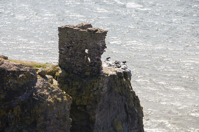
The precarious location of Kaim of Mathers, Aberdeenshire
Introduction
The photograph on this page of The precarious location of Kaim of Mathers, Aberdeenshire by Adrian Diack as part of the Geograph project.
The Geograph project started in 2005 with the aim of publishing, organising and preserving representative images for every square kilometre of Great Britain, Ireland and the Isle of Man.
There are currently over 7.5m images from over 14,400 individuals and you can help contribute to the project by visiting https://www.geograph.org.uk

Image: © Adrian Diack Taken: 2 Jul 2023
This photo, taken from the cliffs nearer the coastal path, shows the precariously poised position of the remainder of Kaim of Mathers. The remaining walls can be seen to be teetering on the edge a chasm created by coastal erosion and cliff collapse. This is a very dangerous location and the safest course of action is to leave it to the cormorants that frequent the spot. While there are warning signs on the clifftop coastal path to say that the path is closed for safety reasons, there are no warning signs near the path that leads to Kaim of Mathers to alert walkers to the extreme danger of trying to climb out on to the rocks that support the ruined building. For safety reasons, I feel that such a notice is urgently needed.

