Alley, St Albans
Introduction
The photograph on this page of Alley, St Albans by Robin Stott as part of the Geograph project.
The Geograph project started in 2005 with the aim of publishing, organising and preserving representative images for every square kilometre of Great Britain, Ireland and the Isle of Man.

There are currently over 7.5m images from over 14,400 individuals and you can help contribute to the project by visiting https://www.geograph.org.uk
Alley, St Albans
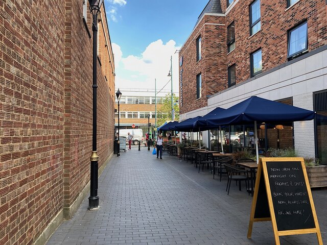
Image: © Robin Stott Taken: 21 Jun 2023
A currently unnamed alley leads from Drovers Way (and car parks) behind the camera to St Peter's Street ahead. On the right here is outdoor seating for the Albans Well pub and bedroom windows of a self-service Travelodge hotel above. After just a glimpse of the area to the rear and west of St Peter's Street, compared with old maps, it is easy to believe that the alley was recently created as part of the hotel development.
Images are licensed for reuse under creativecommons.org/licenses/by-sa/2.0
Image Location
Latitude
51.753891
Longitude
-0.337829