Old Milestone by the A22, london Road, Halsford Green, East Grinstead
Introduction
The photograph on this page of Old Milestone by the A22, london Road, Halsford Green, East Grinstead by Ian King as part of the Geograph project.
The Geograph project started in 2005 with the aim of publishing, organising and preserving representative images for every square kilometre of Great Britain, Ireland and the Isle of Man.

There are currently over 7.5m images from over 14,400 individuals and you can help contribute to the project by visiting https://www.geograph.org.uk
Old Milestone by the A22, london Road, Halsford Green, East Grinstead
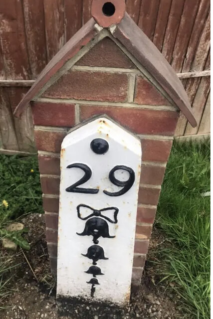
Image: © Ian King Taken: 15 May 2021
Metal plate attached to concrete post by the A22, in parish of East Grinstead (Mid Sussex District), Halsford Green, South of Felbridge, before "The Stennings" by speed camera, on West side of road. Bow Bells iron plate, erected by the Surrey & Sussex turnpike trust in the 19th century. An earlier photograph can be found here https://www.geograph.org.uk/photo/6098328. Inscription reads:- 29 {Bow & 4 Bells} Milestone Society National ID: SX_LL29
Images are licensed for reuse under creativecommons.org/licenses/by-sa/2.0
Image Location
Latitude
51.134499
Longitude
-0.027353