General Wolfe's House
Introduction
The photograph on this page of General Wolfe's House by Philip Halling as part of the Geograph project.
The Geograph project started in 2005 with the aim of publishing, organising and preserving representative images for every square kilometre of Great Britain, Ireland and the Isle of Man.

There are currently over 7.5m images from over 14,400 individuals and you can help contribute to the project by visiting https://www.geograph.org.uk
General Wolfe's House
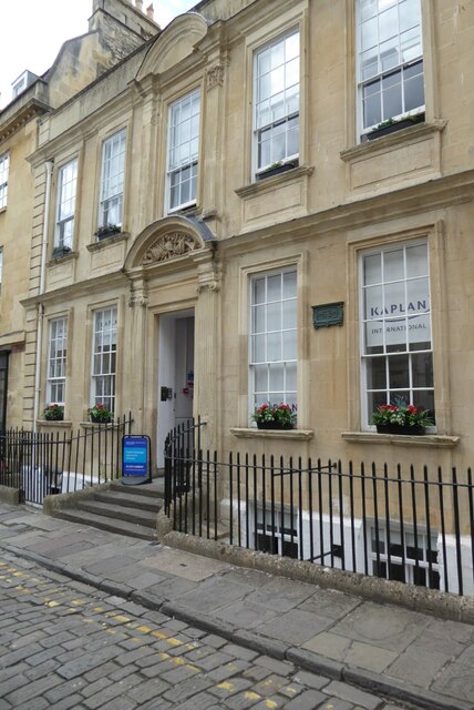
Image: © Philip Halling Taken: 25 Jul 2023
General Wolfe's House on Trim Street. General Wolfe was killed in action at the Battle of the Plains of Abraham in Quebec on 13 September 1759. The house is Grade I listed, see: https://historicengland.org.uk/listing/the-list/list-entry/1395385?section=official-list-entry Wolfe spent the first years of his life living in Westerham in Kent Image
Images are licensed for reuse under creativecommons.org/licenses/by-sa/2.0
Image Location
Latitude
51.382588
Longitude
-2.361769