Levenmouth Rail Link
Introduction
The photograph on this page of Levenmouth Rail Link by Bill Kasman as part of the Geograph project.
The Geograph project started in 2005 with the aim of publishing, organising and preserving representative images for every square kilometre of Great Britain, Ireland and the Isle of Man.

There are currently over 7.5m images from over 14,400 individuals and you can help contribute to the project by visiting https://www.geograph.org.uk
Levenmouth Rail Link
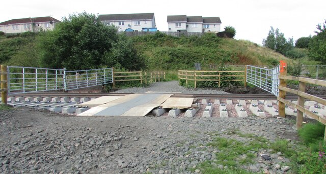
Image: © Bill Kasman Taken: 26 Jul 2023
This level crossing lies on the Mountfleurie path - a pedestrian right-of-way which crosses what was the old railway. Pedestrians have had free access to this crossing since the railway was removed several decades ago. What will happen to this crossing now that the Levenmouth Rail Link https://www.railway-technology.com/projects/levenmouth-rail-link-project-fife-scotland/ is being reinstated and will run this way is unclear. The houses are in Rosemount Grove.
Images are licensed for reuse under creativecommons.org/licenses/by-sa/2.0
Image Location
Latitude
56.194777
Longitude
-3.0215