Ainsworth Street, Blackburn – 1973
Introduction
The photograph on this page of Ainsworth Street, Blackburn – 1973 by Alan Murray-Rust as part of the Geograph project.
The Geograph project started in 2005 with the aim of publishing, organising and preserving representative images for every square kilometre of Great Britain, Ireland and the Isle of Man.

There are currently over 7.5m images from over 14,400 individuals and you can help contribute to the project by visiting https://www.geograph.org.uk
Ainsworth Street, Blackburn – 1973
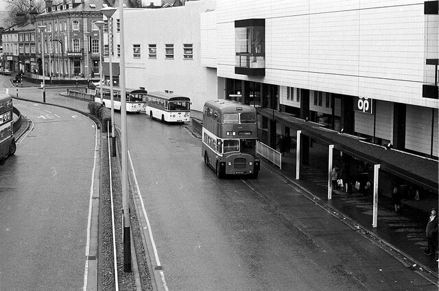
Image: © Alan Murray-Rust Taken: 7 Apr 1973
Ainsworth Street served effectively as a bus station for the Corporation's services, although there was a separate bus station https://www.geograph.org.uk/photo/6746599 used by other operators opposite the railway station. The Co-op buildings on the right have been replaced with more modern retail buildings, the left hand carriageway has been built over by the modern bus station, and the right hand carriageway is pedestrianised. The footbridge, linking to a multi-storey car park, from which this view was taken, has also disappeared. This is one of a series of views featuring buses in the 60s, 70s, and 80s. http://www.geograph.org.uk/search.php?i=137652761
Images are licensed for reuse under creativecommons.org/licenses/by-sa/2.0
Image Location
Latitude
53.749023
Longitude
-2.481274