Benchmark on Black Brook Bridge
Introduction
The photograph on this page of Benchmark on Black Brook Bridge by John S Turner as part of the Geograph project.
The Geograph project started in 2005 with the aim of publishing, organising and preserving representative images for every square kilometre of Great Britain, Ireland and the Isle of Man.

There are currently over 7.5m images from over 14,400 individuals and you can help contribute to the project by visiting https://www.geograph.org.uk
Benchmark on Black Brook Bridge
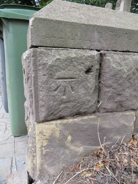
Image: © John S Turner Taken: 7 Aug 2018
Ordnance Survey benchmark on Black Brook Bridge parapet alongside the B5426, east of Rhosllanerchrugog. Levelled at 92.162m above Newlyn Datum, verified 1959. For a wider view see: Image Benchmark database: https://www.bench-marks.org.uk/bm197126
Images are licensed for reuse under creativecommons.org/licenses/by-sa/2.0
Image Location
Latitude
53.004186
Longitude
-3.013059