Woodcote Coach House
Introduction
The photograph on this page of Woodcote Coach House by Richard Law as part of the Geograph project.
The Geograph project started in 2005 with the aim of publishing, organising and preserving representative images for every square kilometre of Great Britain, Ireland and the Isle of Man.

There are currently over 7.5m images from over 14,400 individuals and you can help contribute to the project by visiting https://www.geograph.org.uk
Woodcote Coach House
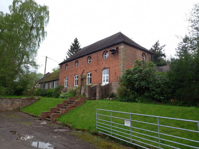
Image: © Richard Law Taken: 1 May 2023
A rear view of the building that was once the coach house to the main hall, now converted to residential use. It consists of an 18th century brick construction over a (possibly older) sandstone plinth or foundation, with stone quoins and a hipped, tiled roof, and was Grade II listed https://britishlistedbuildings.co.uk/101210109-stable-and-coach-house-range-immediately-west-north-west-of-woodcote-hall-chetwynd-aston-and-woodcote & https://historicengland.org.uk/listing/the-list/list-entry/1210109 in 1981, along with the associated former stable buildings. Those are not visible from this direction.
Images are licensed for reuse under creativecommons.org/licenses/by-sa/2.0
Image Location
Latitude
52.736625
Longitude
-2.34667