Old Boundary Marker on Blackrack Bridge
Introduction
The photograph on this page of Old Boundary Marker on Blackrack Bridge by Colin Smith as part of the Geograph project.
The Geograph project started in 2005 with the aim of publishing, organising and preserving representative images for every square kilometre of Great Britain, Ireland and the Isle of Man.

There are currently over 7.5m images from over 14,400 individuals and you can help contribute to the project by visiting https://www.geograph.org.uk
Old Boundary Marker on Blackrack Bridge
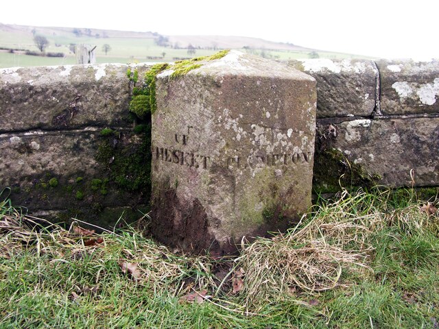
Image: © Colin Smith Taken: 8 Feb 2010
Township Boundary Marker against the parapet of Blackrack Bridge on the east side of the road near Inglewood House. Inscribed UP / HESKET and PLUMPTON on adjacent faces. Up Hesket was a township in Hesket in the Forest parish and Plumpton, formally Plumpton Wall, was a chapelry in Lazonby parish, The boundary is now between Hesket and Lazonby parishes. Grade II Listed details https://historicengland.org.uk/listing/the-list/list-entry/1262198. See also http://www.geog.port.ac.uk/webmap/thelakes/photos/bws14.jpg. Milestone Society National ID: CU_UHEPLU01pb
Images are licensed for reuse under creativecommons.org/licenses/by-sa/2.0
Image Location
Latitude
54.77761
Longitude
-2.811373