Benchmark, Milestone, Brampton Road
Introduction
The photograph on this page of Benchmark, Milestone, Brampton Road by Adrian Taylor as part of the Geograph project.
The Geograph project started in 2005 with the aim of publishing, organising and preserving representative images for every square kilometre of Great Britain, Ireland and the Isle of Man.

There are currently over 7.5m images from over 14,400 individuals and you can help contribute to the project by visiting https://www.geograph.org.uk
Benchmark, Milestone, Brampton Road
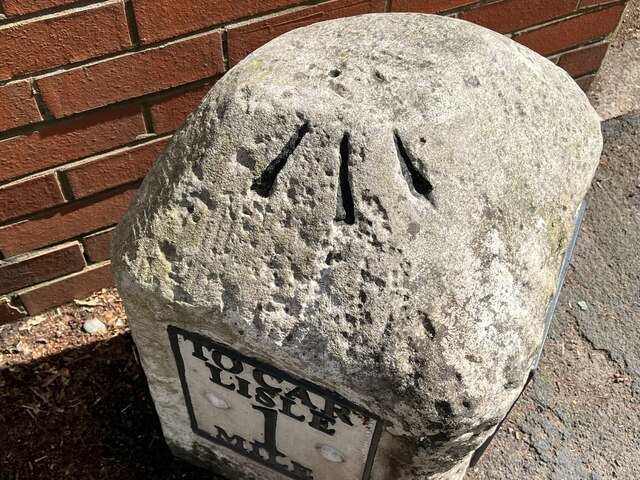
Image: © Adrian Taylor Taken: 29 Jun 2023
Detail of the Ordnance Survey pivot benchmark on the top of the 'Carlisle 1 mile' / 'Newcastle 55 miles' milestone on the southeast side of the B6264 Brampton Road (location photograph Image). The most recent of the two benchmarks on this milestone, this benchmark marks a height of 25.1404m above mean sea level (Ordnance Datum Newlyn) last verified in 1972.
Images are licensed for reuse under creativecommons.org/licenses/by-sa/2.0
Image Location
Latitude
54.906106
Longitude
-2.928652