Old guidestone
Introduction
The photograph on this page of Old guidestone by Chris Minto as part of the Geograph project.
The Geograph project started in 2005 with the aim of publishing, organising and preserving representative images for every square kilometre of Great Britain, Ireland and the Isle of Man.

There are currently over 7.5m images from over 14,400 individuals and you can help contribute to the project by visiting https://www.geograph.org.uk
Old guidestone
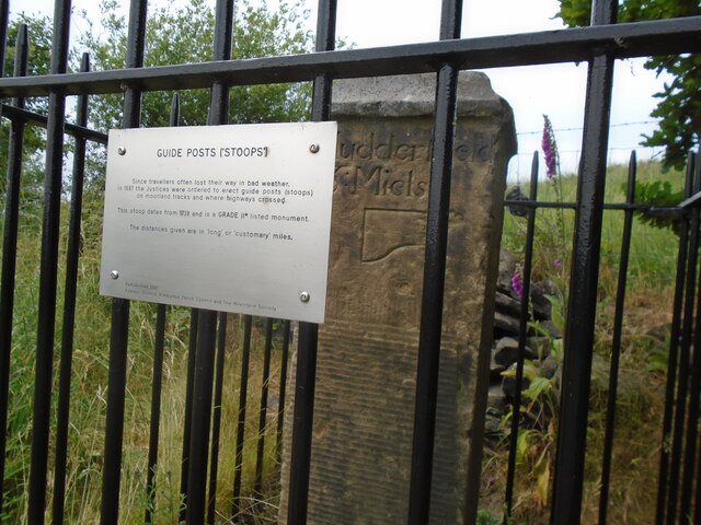
Image: © Chris Minto Taken: 18 Jun 2023
This plaque on the railings surrounding the stoop explains about is origins. GUIDEPOSTS (STOOPS). Since travellers often lost their way in bad weather, in 1697 the Justices were ordered to erect guideposts (stoops) on moorland tracks and where highways crossed. This stoop dates from 1738 and is a Grade II* listed monument. The distances given are in 'long' or 'customary' miles. Refurbished 2007 Kirklees Council, Kirkburton Parish Council and the Milestone Society.
Images are licensed for reuse under creativecommons.org/licenses/by-sa/2.0
Image Location
Latitude
53.599718
Longitude
-1.750335