Development, Aldgate
Introduction
The photograph on this page of Development, Aldgate by Stephen Richards as part of the Geograph project.
The Geograph project started in 2005 with the aim of publishing, organising and preserving representative images for every square kilometre of Great Britain, Ireland and the Isle of Man.

There are currently over 7.5m images from over 14,400 individuals and you can help contribute to the project by visiting https://www.geograph.org.uk
Development, Aldgate
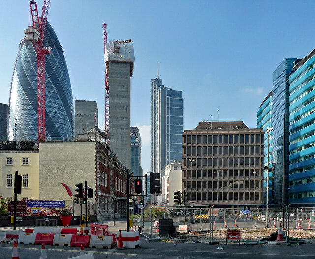
Image: © Stephen Richards Taken: 4 Oct 2015
Looking north beyond Aldgate Square. The prominent central tower used be called Heron Tower but has been bathetically re-named Salesforce Tower. The core on the left probably grew up to be One Creechurch Place.
Images are licensed for reuse under creativecommons.org/licenses/by-sa/2.0
Image Location
Latitude
51.514243
Longitude
-0.078355