The Weardale Way passing beneath Victoria Viaduct
Introduction
The photograph on this page of The Weardale Way passing beneath Victoria Viaduct by Tim Heaton as part of the Geograph project.
The Geograph project started in 2005 with the aim of publishing, organising and preserving representative images for every square kilometre of Great Britain, Ireland and the Isle of Man.

There are currently over 7.5m images from over 14,400 individuals and you can help contribute to the project by visiting https://www.geograph.org.uk
The Weardale Way passing beneath Victoria Viaduct
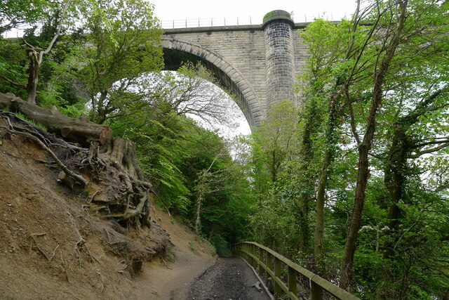
Image: © Tim Heaton Taken: 18 May 2023
The railway viaduct was built in 1838, the year of Victoria's coronation, and was one of the largest bridges in Europe. It carried trains until 1991, since when it has been mothballed https://www.bridgesonthetyne.co.uk/fatvic.html . Next to the path an unstable beech tree has been recently felled
Images are licensed for reuse under creativecommons.org/licenses/by-sa/2.0
Image Location
Latitude
54.884592
Longitude
-1.502569