Towy Valley Farms and Farmland
Introduction
The photograph on this page of Towy Valley Farms and Farmland by Anthony Stevenson as part of the Geograph project.
The Geograph project started in 2005 with the aim of publishing, organising and preserving representative images for every square kilometre of Great Britain, Ireland and the Isle of Man.

There are currently over 7.5m images from over 14,400 individuals and you can help contribute to the project by visiting https://www.geograph.org.uk
Towy Valley Farms and Farmland
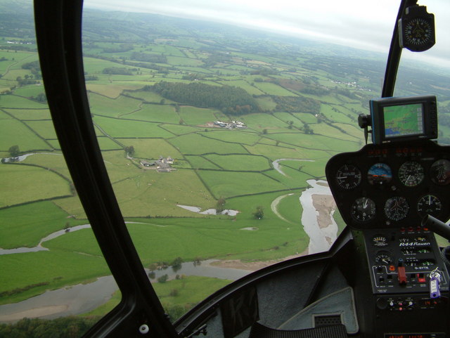
Image: © Anthony Stevenson Taken: 25 Sep 2004
The farm in the foreground is Pentre-Davis and the one behind and to the right is Alltygaer. Notice the numerous oxbow lakes of the River Towy in the foreground. Behind Alltygaer is a 140m high hill upon which once stood a fort, Grongaer. Behind this (just above the helicopter's satnav) is Aberglasney.
Images are licensed for reuse under creativecommons.org/licenses/by-sa/2.0
Image Location


Leaflet Map data © OpenStreetMap
Latitude
51.865651
Longitude
-4.075349