Chantry Chapel, Three Kings Yard
Introduction
The photograph on this page of Chantry Chapel, Three Kings Yard by pam fray as part of the Geograph project.
The Geograph project started in 2005 with the aim of publishing, organising and preserving representative images for every square kilometre of Great Britain, Ireland and the Isle of Man.

There are currently over 7.5m images from over 14,400 individuals and you can help contribute to the project by visiting https://www.geograph.org.uk
Chantry Chapel, Three Kings Yard
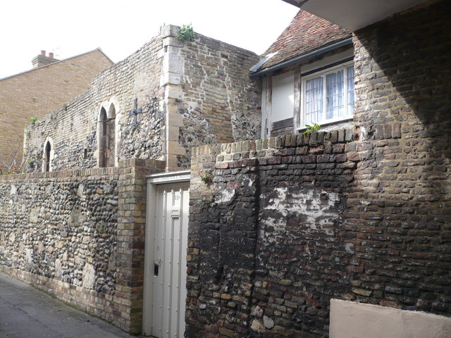
Image: © pam fray Taken: 4 Apr 2008
Built circa 1250 as a merchant's house, it became a chapel then fell into ruin after the Dissolution. It was restored by Dutch refugees as a house then was left to become a ruin again.
Images are licensed for reuse under creativecommons.org/licenses/by-sa/2.0
Image Location
Latitude
51.275044
Longitude
1.341106