
Old milestone
Introduction
The photograph on this page of Old milestone by Chris Minto as part of the Geograph project.
The Geograph project started in 2005 with the aim of publishing, organising and preserving representative images for every square kilometre of Great Britain, Ireland and the Isle of Man.

There are currently over 7.5m images from over 14,400 individuals and you can help contribute to the project by visiting https://www.geograph.org.uk
Old milestone
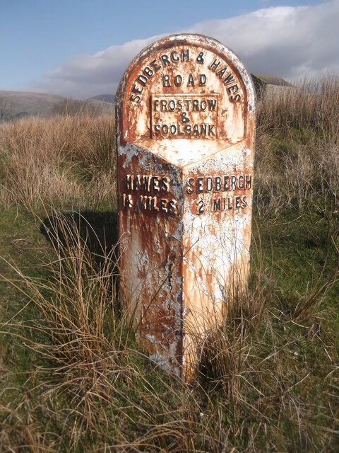
Image: © Chris Minto Taken: 9 Apr 2019
This is the only West Riding CC milestone between Ribblehead and Sedbergh that is set on the north side of the A684. It is on the verge just above a cattle grid. It is possible that this is an early replacement as none of the others have the parish name on a plate. There is an OS pin in the top and a cut benchmark on the back at the top of the stone. It is Grade II listed 1384135.
Images are licensed for reuse under creativecommons.org/licenses/by-sa/2.0
Image Location

Latitude
54.316679
Longitude
-2.482959