Stile, boundary, boundary marker and valve house
Introduction
The photograph on this page of Stile, boundary, boundary marker and valve house by Christine Johnstone as part of the Geograph project.
The Geograph project started in 2005 with the aim of publishing, organising and preserving representative images for every square kilometre of Great Britain, Ireland and the Isle of Man.

There are currently over 7.5m images from over 14,400 individuals and you can help contribute to the project by visiting https://www.geograph.org.uk
Stile, boundary, boundary marker and valve house
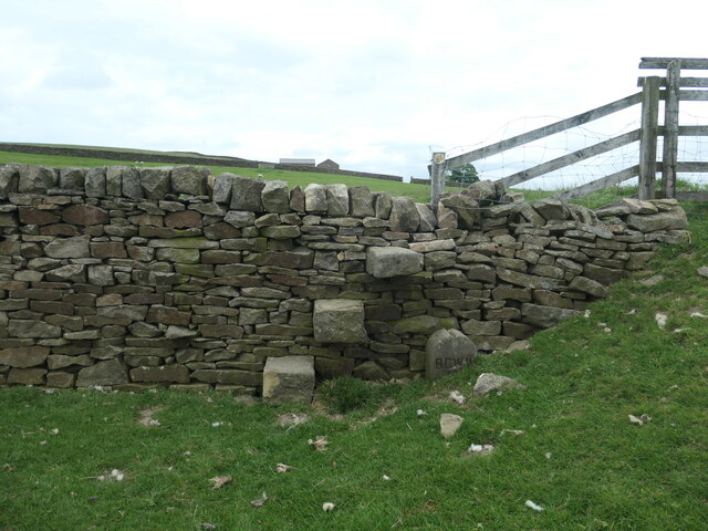
Image: © Christine Johnstone Taken: 28 May 2023
The stile carries the public footpath between Highfield Farm and Berwick East. The wall is the boundary between Bradford MDC, West Yorkshire [this / south side] and Craven, North Yorkshire [far / north side]. The BCWW boundary marker refers to Bradford Corporation Water Works, which opened the nearby Chelker reservoir in 1866. On the horizon is the valve house, which relates to the covered pipeline Image immediately to the right of this image.
Images are licensed for reuse under creativecommons.org/licenses/by-sa/2.0
Image Location
Latitude
53.958202
Longitude
-1.905324