The Brierdene, Whitley Bay
Introduction
The photograph on this page of The Brierdene, Whitley Bay by Geoff Holland as part of the Geograph project.
The Geograph project started in 2005 with the aim of publishing, organising and preserving representative images for every square kilometre of Great Britain, Ireland and the Isle of Man.

There are currently over 7.5m images from over 14,400 individuals and you can help contribute to the project by visiting https://www.geograph.org.uk
The Brierdene, Whitley Bay
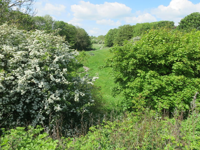
Image: © Geoff Holland Taken: 23 May 2023
The Brierdene is an area managed by Friends of Brierdene www.friendsofbrierdene.org.uk with assistance from North Tyneside Council. This poem was inspired by the dene and first appeared in the book, 'Green Spaces Parks, Poetry and Hidden Nature in North Tyneside' published by North Tyneside Council and Northern Voices Community Projects. BRIERDENE Woods were once swung here, sand wedges, chips and pitches, fairways and manicured greens, golfers aiming putters with precision, brightly patterned sweaters, and a wee flagged hole at the end of it all. They took the rough with the smooth. Now, sandwiched between houses, surrounded by a rich variety of trees, the burn slips quietly past and, a pebble's throw away, it spills out across the sands. I have often wondered just how many culverts has it flowed through on its journey from its source to the sea. I have wondered how many farms have seen its rise and fall, its cargo of water borne debris, logs, sticks and branches, rich pickings from upstream. From this sheltered dene, far removed from the seaside hurly-burly, I watch the seasons change, the migrants come and go, the trees cast off their leaves. And when, in time, it is all done, I will watch the cycle start again. Nature has me in her grip. The poem was written by Geoff Holland
Images are licensed for reuse under creativecommons.org/licenses/by-sa/2.0
Image Location


Leaflet Map data © OpenStreetMap
Latitude
55.058099
Longitude
-1.456118