Pillbox, Cranny Road, Craigavon
Introduction
The photograph on this page of Pillbox, Cranny Road, Craigavon by P Flannagan as part of the Geograph project.
The Geograph project started in 2005 with the aim of publishing, organising and preserving representative images for every square kilometre of Great Britain, Ireland and the Isle of Man.

There are currently over 7.5m images from over 14,400 individuals and you can help contribute to the project by visiting https://www.geograph.org.uk
Pillbox, Cranny Road, Craigavon
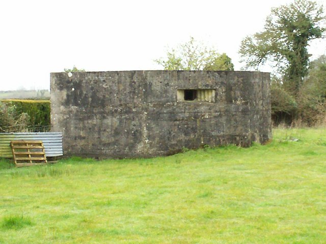
Image: © P Flannagan Taken: 2 Apr 2008
Pillboxes were small concrete forts of various shapes and sizes, built as anti invasion defences during the second world war throughout Britain and Northern Ireland.
Images are licensed for reuse under creativecommons.org/licenses/by-sa/2.0
Image Location
Latitude
54.42635
Longitude
-6.371093