Princes Risborough: The Bird in Hand public house
Introduction
The photograph on this page of Princes Risborough: The Bird in Hand public house by Nigel Cox as part of the Geograph project.
The Geograph project started in 2005 with the aim of publishing, organising and preserving representative images for every square kilometre of Great Britain, Ireland and the Isle of Man.

There are currently over 7.5m images from over 14,400 individuals and you can help contribute to the project by visiting https://www.geograph.org.uk
Princes Risborough: The Bird in Hand public house
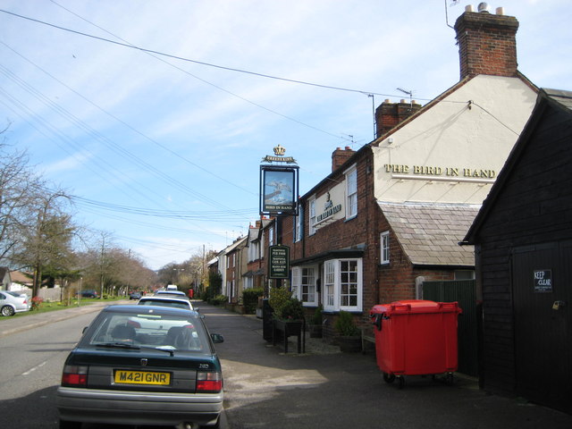
Image: © Nigel Cox Taken: 30 Mar 2008
This Greene King pub is on the east side of the B4444 Station Road in the Parkfield area of Princes Risborough. The 1878 Ordnance Survey map of the area shows Parkfield to be a triangular shaped settlement, quite discrete from Princes Risborough, and bounded on its three side by the Wycombe Road, Station Road and Poppy Road, and then by fields beyond the roads.
Images are licensed for reuse under creativecommons.org/licenses/by-sa/2.0
Image Location
Latitude
51.718188
Longitude
-0.839009