Drill Hall, Seaford, 2010
Introduction
The photograph on this page of Drill Hall, Seaford, 2010 by Robin Webster as part of the Geograph project.
The Geograph project started in 2005 with the aim of publishing, organising and preserving representative images for every square kilometre of Great Britain, Ireland and the Isle of Man.

There are currently over 7.5m images from over 14,400 individuals and you can help contribute to the project by visiting https://www.geograph.org.uk
Drill Hall, Seaford, 2010
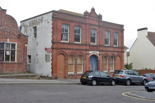
Image: © Robin Webster Taken: 15 Jul 2010
The red sign advises that it is the base of No. 2 Cadet Platoon, Sussex, Army Cadet Force. However, it does not look in much use, and was later converted to flats. It was built in 1898, called Queen's Hall, which name has been carried forward to the current flats.
Images are licensed for reuse under creativecommons.org/licenses/by-sa/2.0
Image Location
Latitude
50.773523
Longitude
0.101753