Duke of Edinburgh Road
Introduction
The photograph on this page of Duke of Edinburgh Road by Ian Capper as part of the Geograph project.
The Geograph project started in 2005 with the aim of publishing, organising and preserving representative images for every square kilometre of Great Britain, Ireland and the Isle of Man.

There are currently over 7.5m images from over 14,400 individuals and you can help contribute to the project by visiting https://www.geograph.org.uk
Duke of Edinburgh Road
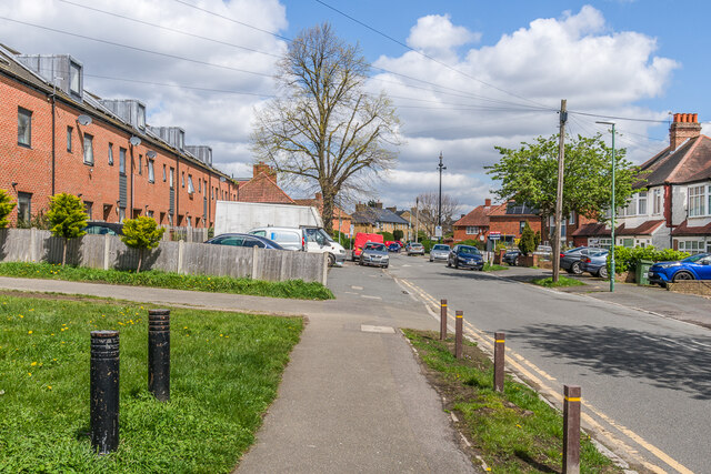
Image: © Ian Capper Taken: 25 Apr 2023
Houses in Duke of Edinburgh Road, a road marked on the 1898 6 inch map and 1913 25 inch map (both simply as Edinburgh Road) only with a few houses at its northern end, where the terrace on the left in this photo now stand. The houses on the right are later, being first shown on the 1935 25 inch map (with the road named as currently). In the right background is the sewer vent column in Image and Image
Images are licensed for reuse under creativecommons.org/licenses/by-sa/2.0
Image Location
Latitude
51.376537
Longitude
-0.181923