Laburnum Avenue
Introduction
The photograph on this page of Laburnum Avenue by Ian Capper as part of the Geograph project.
The Geograph project started in 2005 with the aim of publishing, organising and preserving representative images for every square kilometre of Great Britain, Ireland and the Isle of Man.

There are currently over 7.5m images from over 14,400 individuals and you can help contribute to the project by visiting https://www.geograph.org.uk
Laburnum Avenue
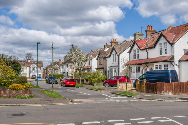
Image: © Ian Capper Taken: 25 Apr 2023
Houses in Laburnum Avenue. The nearest three semi-detached pairs (together with a corresponding trio on the left hand side of the road, off the side of the photo) are marked on the 1913 25 inch map as an isolated group named Laburnum Villas, with no other housing within 300m. Full development of the area had taken place by the 1935 edition. In the left background is the sewer vent column in Image
Images are licensed for reuse under creativecommons.org/licenses/by-sa/2.0
Image Location
Latitude
51.370875
Longitude
-0.175194