King John's House, Romsey
Introduction
The photograph on this page of King John's House, Romsey by Oscar Taylor as part of the Geograph project.
The Geograph project started in 2005 with the aim of publishing, organising and preserving representative images for every square kilometre of Great Britain, Ireland and the Isle of Man.

There are currently over 7.5m images from over 14,400 individuals and you can help contribute to the project by visiting https://www.geograph.org.uk
King John's House, Romsey
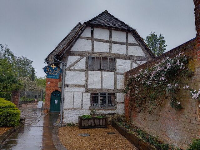
Image: © Oscar Taylor Taken: 6 May 2023
Known as King John's House, there are actually three buildings here: 1 Church Court, Tudor Cottage and King John's House. They are used as one building. They date from the 12th and 16th centuries, and are Grade I, II and II* listed, list entry numbers 1231711 https://historicengland.org.uk/listing/the-list/list-entry/1231711 , 1231712 https://historicengland.org.uk/listing/the-list/list-entry/1231712 and 1231745 https://historicengland.org.uk/listing/the-list/list-entry/1231745
Images are licensed for reuse under creativecommons.org/licenses/by-sa/2.0
Image Location
Latitude
50.989849
Longitude
-1.499855