Victorian Postbox, Upper Saint Giles Street
Introduction
The photograph on this page of Victorian Postbox, Upper Saint Giles Street by Mark Anderson as part of the Geograph project.
The Geograph project started in 2005 with the aim of publishing, organising and preserving representative images for every square kilometre of Great Britain, Ireland and the Isle of Man.

There are currently over 7.5m images from over 14,400 individuals and you can help contribute to the project by visiting https://www.geograph.org.uk
Victorian Postbox, Upper Saint Giles Street
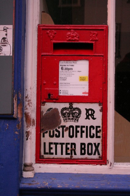
Image: © Mark Anderson Taken: 5 Nov 2005
This is one of the Ludlow post boxes. Although the initials at the top are VR, the damaged white panel looks like it once had the initials GR.
Images are licensed for reuse under creativecommons.org/licenses/by-sa/2.0
Image Location


Leaflet Map data © OpenStreetMap
Latitude
52.628625
Longitude
1.286239