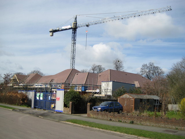
Princes Risborough: Former Berryfield Road Infants' School (1)
Introduction
The photograph on this page of Princes Risborough: Former Berryfield Road Infants' School (1) by Nigel Cox as part of the Geograph project.
The Geograph project started in 2005 with the aim of publishing, organising and preserving representative images for every square kilometre of Great Britain, Ireland and the Isle of Man.
There are currently over 7.5m images from over 14,400 individuals and you can help contribute to the project by visiting https://www.geograph.org.uk

Image: © Nigel Cox Taken: 30 Mar 2008
The School, which is shown on all the current OS maps, has been razed to the ground, and a 90 room care home for older people is under construction on the site. At first I thought this was an illustration of changing population demographics with fewer school children and more elderly people being needed to be provided for, but looking at Buckinghamshire Local Education Authority's formal closure notice for the School it appears that the purpose was to provide a new 360 place infants' school in the grounds of the local junior school, Icknield Junior, in Wellington Avenue, in line with the County Council's policy of amalgamating infant and junior schools where possible because it means fewer changes and more stability for children. From the closure notice it appears that the intention was to close the school with effect from 31 December 2001.

