Twickenham Rough
Introduction
The photograph on this page of Twickenham Rough by Mark Percy as part of the Geograph project.
The Geograph project started in 2005 with the aim of publishing, organising and preserving representative images for every square kilometre of Great Britain, Ireland and the Isle of Man.

There are currently over 7.5m images from over 14,400 individuals and you can help contribute to the project by visiting https://www.geograph.org.uk
Twickenham Rough
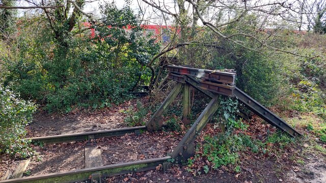
Image: © Mark Percy Taken: 17 Mar 2023
Maintained by Richmond Council, this linear conservation site links Twickenham Station and Marsh Farm Lane, with a surfaced path running parallel to the River Crane and the railway. In a nod to the site's former use as a railway siding, a set of buffers and a short stretch of track have been left as a feature.
Images are licensed for reuse under creativecommons.org/licenses/by-sa/2.0
Image Location
Latitude
51.449109
Longitude
-0.335882