Bath Road
Introduction
The photograph on this page of Bath Road by Ian Capper as part of the Geograph project.
The Geograph project started in 2005 with the aim of publishing, organising and preserving representative images for every square kilometre of Great Britain, Ireland and the Isle of Man.

There are currently over 7.5m images from over 14,400 individuals and you can help contribute to the project by visiting https://www.geograph.org.uk
Bath Road
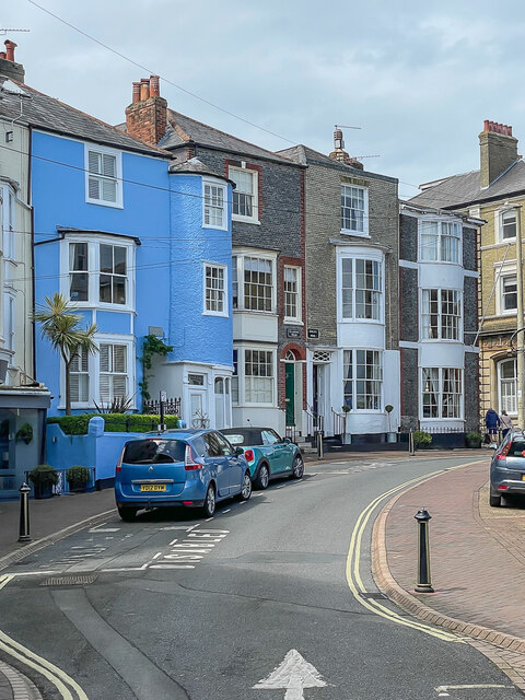
Image: © Ian Capper Taken: 16 May 2022
The northern extension of High Street, with houses dating from the early 19th Century. From left to right are Tower House, The Turret (both blue painted, with The Turret being the narrow section on the right), Clarence House, Exmouth House and Bars Hill House. The last four are all grade II listed - see https://historicengland.org.uk/listing/the-list/list-entry/1267735?section=official-list-entry, https://historicengland.org.uk/listing/the-list/list-entry/1239820?section=official-list-entry, https://historicengland.org.uk/listing/the-list/list-entry/1239821?section=official-list-entry and https://historicengland.org.uk/listing/the-list/list-entry/1239822?section=official-list-entry respectively. For a wider view see Image
Images are licensed for reuse under creativecommons.org/licenses/by-sa/2.0
Image Location
Latitude
50.764661
Longitude
-1.299196