Benchmark on Holy Cross Church
Introduction
The photograph on this page of Benchmark on Holy Cross Church by Roger Templeman as part of the Geograph project.
The Geograph project started in 2005 with the aim of publishing, organising and preserving representative images for every square kilometre of Great Britain, Ireland and the Isle of Man.

There are currently over 7.5m images from over 14,400 individuals and you can help contribute to the project by visiting https://www.geograph.org.uk
Benchmark on Holy Cross Church
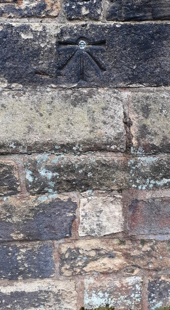
Image: © Roger Templeman Taken: 14 Apr 2023
Ordnance Survey 1GL bolt benchmark levelled at 121.923m above Newlyn Datum verified 1954. Previously levelled at 399.984 feet above Liverpool Datum in 1844 during the Carlisle to North Shields 1GL Survey. The surveyor's description was 'No. 78. Bolt in North-east corner of Haltwhistle Parish Church ; 2.80 ft. above surface'
Images are licensed for reuse under creativecommons.org/licenses/by-sa/2.0
Image Location
Latitude
54.970124
Longitude
-2.458093