Old milestone
Introduction
The photograph on this page of Old milestone by Chris Minto as part of the Geograph project.
The Geograph project started in 2005 with the aim of publishing, organising and preserving representative images for every square kilometre of Great Britain, Ireland and the Isle of Man.

There are currently over 7.5m images from over 14,400 individuals and you can help contribute to the project by visiting https://www.geograph.org.uk
Old milestone
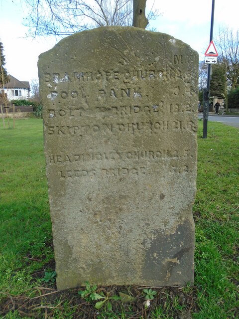
Image: © Chris Minto Taken: 19 Mar 2023
On the northeast corner of Church Lane is the fourth of these large informative stones in this grid square. As well as distances to bridges and churches this mentions Pool Bank. This is the very steep hill now called Old Pool Bank leading from the tollhouse to the village of Pool at the A658 and A659 junction.
Images are licensed for reuse under creativecommons.org/licenses/by-sa/2.0
Image Location
Latitude
53.854185
Longitude
-1.591482