Old Bridge Marker at Low Mills Farm on the A659
Introduction
The photograph on this page of Old Bridge Marker at Low Mills Farm on the A659 by C Minto as part of the Geograph project.
The Geograph project started in 2005 with the aim of publishing, organising and preserving representative images for every square kilometre of Great Britain, Ireland and the Isle of Man.

There are currently over 7.5m images from over 14,400 individuals and you can help contribute to the project by visiting https://www.geograph.org.uk
Old Bridge Marker at Low Mills Farm on the A659
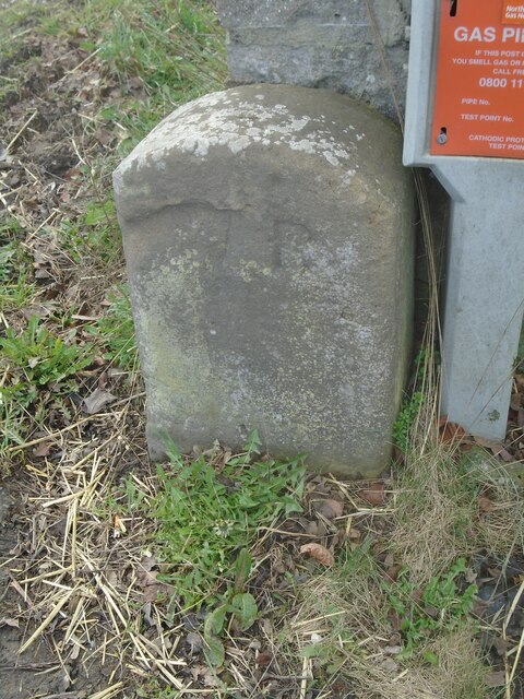
Image: © C Minto Taken: 19 Mar 2023
County Bridge Marker 60 metres southeast of Firgreen Beck, against the gatepost at the entrance to Low Mills Farm on the southwest side of the A659. Boston Spa parish. Inscribed W R, the stone marks the extent of roadway adjoining the bridge that the County was obliged to maintain. See also https://www.geograph.org.uk/photo/6034700. Milestone Society National ID: YW_BSPA01br
Images are licensed for reuse under creativecommons.org/licenses/by-sa/2.0
Image Location
Latitude
53.898925
Longitude
-1.329043