Catgallow's Bridge near Chilvers Coton in Nuneaton
Introduction
The photograph on this page of Catgallow's Bridge near Chilvers Coton in Nuneaton by Roger Kidd as part of the Geograph project.
The Geograph project started in 2005 with the aim of publishing, organising and preserving representative images for every square kilometre of Great Britain, Ireland and the Isle of Man.

There are currently over 7.5m images from over 14,400 individuals and you can help contribute to the project by visiting https://www.geograph.org.uk
Catgallow's Bridge near Chilvers Coton in Nuneaton
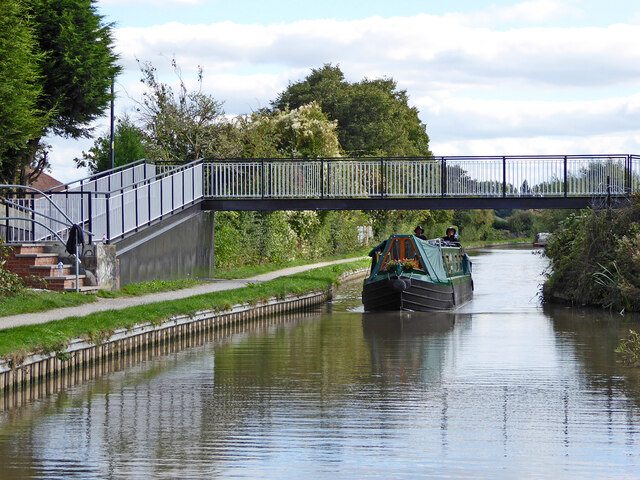
Image: © Roger Kidd Taken: 22 Sep 2016
This is the Coventry Canal, looking south-east as the waterway meanders towards Marston Junction and Bedworth. There are extensive allotments and housing off to the right, and housing off to the left. There were already allotments shown here on Victorian maps. Catgallow's Bridge is No 20A. Apparently the original bridge was wooden. https://www.coventrytelegraph.net/news/local-news/nuneaton-cat-gallows-why-called-13708180
Images are licensed for reuse under creativecommons.org/licenses/by-sa/2.0
Image Location
Latitude
52.517433
Longitude
-1.475921