View of the Calder valley from Exley Lane, Elland
Introduction
The photograph on this page of View of the Calder valley from Exley Lane, Elland by Humphrey Bolton as part of the Geograph project.
The Geograph project started in 2005 with the aim of publishing, organising and preserving representative images for every square kilometre of Great Britain, Ireland and the Isle of Man.

There are currently over 7.5m images from over 14,400 individuals and you can help contribute to the project by visiting https://www.geograph.org.uk
View of the Calder valley from Exley Lane, Elland
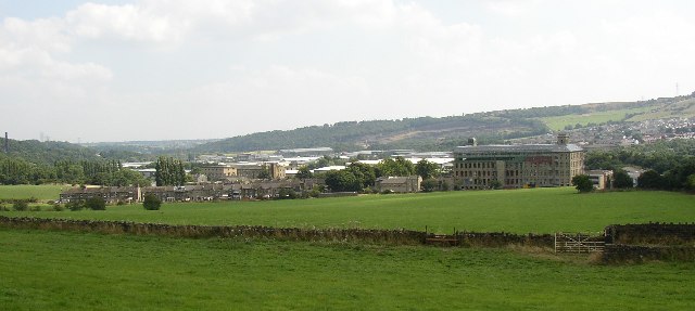
Image: © Humphrey Bolton Taken: 17 Aug 2005
Towards the right is a large mill building being converted to flats. Towards the left a long row of terrace houses built for mill workers, with more mill buildings behind and the clay pipes works chimney at the far left. Further away in the centre are a large number of modern warehouse or factory buildings - big sheds. This is the Lowfields Industrial Estate. On the hillside above them the scar of a shale quarry - the shale is used for making bricks.
Images are licensed for reuse under creativecommons.org/licenses/by-sa/2.0
Image Location


Leaflet Map data © OpenStreetMap
Latitude
53.690739
Longitude
-1.837931