Metrolink Viaduct at Castlefield (view from the 'Sky Park')
Introduction
The photograph on this page of Metrolink Viaduct at Castlefield (view from the 'Sky Park') by David Dixon as part of the Geograph project.
The Geograph project started in 2005 with the aim of publishing, organising and preserving representative images for every square kilometre of Great Britain, Ireland and the Isle of Man.

There are currently over 7.5m images from over 14,400 individuals and you can help contribute to the project by visiting https://www.geograph.org.uk
Metrolink Viaduct at Castlefield (view from the 'Sky Park')
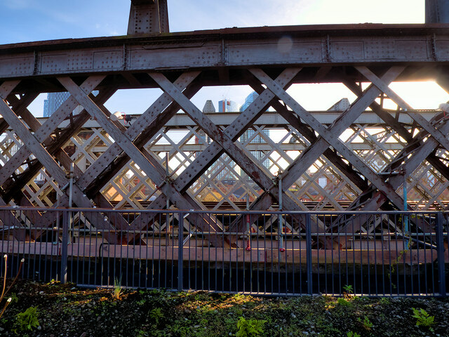
Image: © David Dixon Taken: 23 Feb 2023
Three viaducts, built by competing railway companies during the nineteenth century, run through Castlefield into Manchester city centre. The middle one has been disused since it was closed in 1969whilst the one immediately to the south of it has been converted for use by the Metrolink tramway. This view is from the central viaduct, looking towards the one now used by Metrolink.
Images are licensed for reuse under creativecommons.org/licenses/by-sa/2.0
Image Location
Latitude
53.475034
Longitude
-2.256088