Staffordshire farmland near Coven
Introduction
The photograph on this page of Staffordshire farmland near Coven by Roger Kidd as part of the Geograph project.
The Geograph project started in 2005 with the aim of publishing, organising and preserving representative images for every square kilometre of Great Britain, Ireland and the Isle of Man.

There are currently over 7.5m images from over 14,400 individuals and you can help contribute to the project by visiting https://www.geograph.org.uk
Staffordshire farmland near Coven
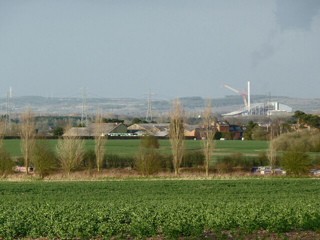
Image: © Roger Kidd Taken: 19 Apr 2013
This is a telephoto assisted view, looking north-east from the Monarch's Way bridleway near Long Birch Farm. In the foreground beyond the crop field are poplar trees by the Shropshire Union Canal (250 metres). The mid-ground buildings are at Brewood Park Farm, (about a thousand metres away). On the right, just over two and a half miles away (4·2km) is the new Four Ashes Incinerator, still under construction. On the skyline is Cannock Chase, about ten miles (sixteen kilometres) distant.
Images are licensed for reuse under creativecommons.org/licenses/by-sa/2.0
Image Location
Latitude
52.656755
Longitude
-2.153852